When I was looking at real estate in and around High Springs
(where I did, eventually, purchase a home back in 2014), I remember having a
conversation with my mother in which we mused about the reason why High Springs
was named High Springs. We thought the name was a bit odd, as it wasn’t as if
there were a spring in the center of town or anything. However, we decided that
perhaps the name probably came from the high quantity of springs in the near
vicinity of the town; Poe, Gilchrist Blue, Ginnie, and Rum Island springs are
all short drives from High Springs, and many other springs are accessible via
the nearby Santa Fe River. This is apparently the etymology of the town’s name
that many people in North Florida believe, although it turns out that it is not,
in fact, correct.
While doing research for my various High Springs railroad posts, I learned that there had indeed
once been a spring in High Springs proper. According to the Architectural and Historical Survey of High Springs, Florida, published in 1990, “The spring that gives High Springs its name is located a mile
northeast of the current center of town, in what is now a pleasant residential
suburb. Its steady flow of water attracted settlers in the latter part of the
nineteenth century, and the first group of buildings – a school, a few stores,
and several homes – was built here. The railroad tapped this spring and
diverted its flow, via a long pipe, to the site chosen for the railroad shops.”
As I continued to search for more information on the railyard in High Springs,
I came across several other mentions of a spring on top of a hill north of town
giving rise to the town’s name… but where had the spring been?
I got my answer when JOM and I visited the High Springs Historical Museum
to learn more about the railroad back in the fall. We were told where exactly
this ‘hill north of town’ was located, that there were remains of the
springhouse, and that the spring itself even still flowed. Sort of. In a bit of
a trickle. We also learned that there were plans being discussed to clean the
area up and turn it into a park – perhaps even to restore the springs –
although nothing had been decided.
Due to busy schedules and plans to explore other places, I
didn’t get a chance to follow the directions I’d been given in search of the
old springs until yesterday. And as JOM is off cycling around Australia, I went hunting for it by myself. The directions I’d
been given led me up a hill and to a trail entering a wooded area northeast of
downtown High Springs, and while they weren’t too specific for once I reached
said wooded area, I vaguely remembered being told that the area was marked off
with caution tape. Shortly after entering the woods, I began to come across the
remains of structures: foundations, collapsing remains of wooden walls, and concrete
structures. Initially I thought I might have found the old springhouse… until I
noticed the old tobacco barn behind it. That didn’t seem to fit what I was looking
for. Additionally, I couldn’t find anything that resembled a spring – not even
a trickle.
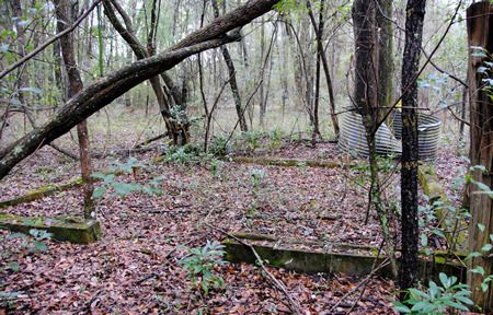
Foundations of something
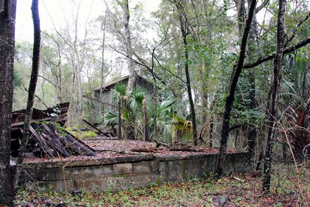
More foundations; tobacco barn in the distance
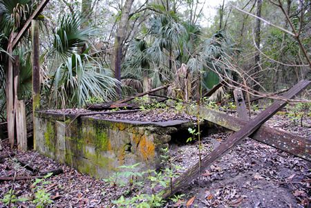
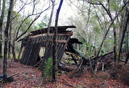
Collapsing wooden structure
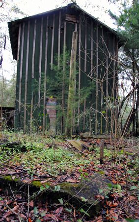
The tobacco drying barn told me I was looking in the wrong place.
And so I continued on, following the trail until in the
distance I saw what looked like yellow caution tape tied around a tree:
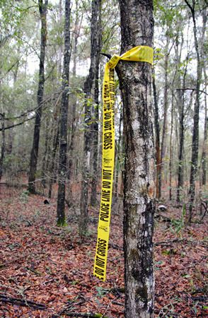
Er. That’s caution tape, right?
Looking into the woods, I could see another band of yellow
tape around another tree, and then farther into the woods, yet another.
Following a Hansel and Gretel breadcrumb trail of police-line-do-not-cross tape
into the forest all by your lonesome is surely a good idea. I figured either
this was the caution tape that I thought I remembered hearing about, or I’d
find myself arrested for trampling over a murder scene. As there hadn’t been
any recent murders in the area (to my knowledge anyway), I figured I had to be on the right track.
Safety first!
The pieces of yellow tape did indeed lead me to the spring –
or what was left of it – and I would never have found it without them. When I
finally reached the last piece of yellow tape in the trail, I could see what
looked like a round clearing in the woods. It was impossible to get a
photograph that showed what I could discern: a near perfect circle of slightly
depressed land covered in weeds and small trees, surrounded by much older
trees. Venturing into the depressed circle, I could tell that this had indeed
once been the spring head pool. Around the edges older oaks leaned over what
would have once been water. The ‘pool’ itself was nothing but mud – wet enough
to show that water was still seeping to the surface, but dry(ish) enough to
walk across, although my shoes definitely sunk into the mud in spots.
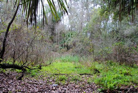
What remains of what would have been the spring's pool
On one end of the former ‘pool’ the remains of a dam and
pipe could be seen… and flowing through it and down an old creek bed was the
trickle of water I had been told to expect.
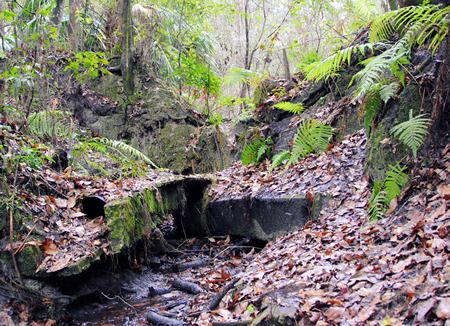
Remains of the dam. The round object in the lower left quadrant is a pipe.
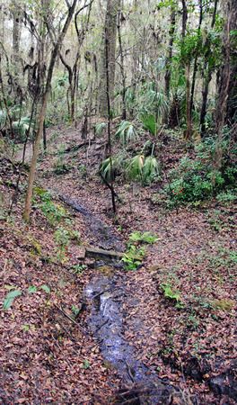
The stream, trickling east from the dam/pool
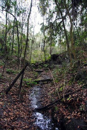
Looking back towards the spring from downstream; the dam is at the top of the hill.
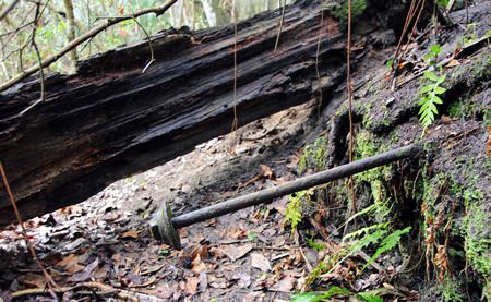
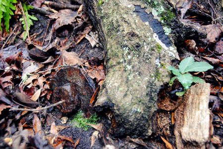
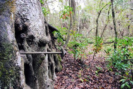
On the opposite side of the ‘pool’ I found three large metal
bolts extending inward from the ‘pool’ wall. I've no idea what their purpose would have been.
The complete set of photos taken on my explorations in
search of the original High Springs Spring can be seen HERE.
According to the Alachua County Property Appraiser’s
website, the piece of land upon which what remains of the spring sits belongs
to the City of High Springs, which would certainly simplify the process of turning it
into a city park. Of course, whether or not this actually comes to fruition
definitely remains to be seen. And restoration of the spring itself? I do not
know if such a thing would be possible, although if it were, that would indeed
be lovely.

I'm guessing the bolts were once part of a retaining wall, probably wood. The bolt likely connected the wall to a buried "deadman".
ReplyDeleteThat does seem likely. The bolts were the only visible evidence of human intervention on that side of the spring pool.
DeleteThis is great! Thanks so much for the description and the photos.
ReplyDeleteGlad you enjoyed it!
DeleteI have lived here 30 years and have never known this. I would love to explore this place with my family!
ReplyDeleteI have lived here 30 years and have never known this. I would love to explore this place with my family!
ReplyDeleteI had heard there was a High Springs namesake spring but someone told me it was by the museum. This makes more sense.
ReplyDeleteAs a kid I use to play in the old reservoir. We would get stuck, on purpose, in the mud.. I remember getting buried up to my knees..
ReplyDeleteCan we get a better description of the location? We would like to explore that area, too. Wonderful pictures - thank you for sharing them.
ReplyDeleteWhat a nice article! I'm passing it on to friends who live there.
ReplyDeleteThanks for a great post! It inspired us to go explore it firsthand last weekend. Roger at the museum was very helpful to explain the location and how to get there. I did record the coordinates as 29' 49.889 N -82'35.365 W
ReplyDeleteIs 29' 49.889 N -82'35.365 W correct?
DeleteLooks about right.
DeleteYou wrote it well. I really like such things.
ReplyDeleteDenis
That would be why the school next to it was originally called Spring Hill Elementary. In the 80's the spring flowed back towards the school and dissipated in the woods just before reaching the racket ball courts.
ReplyDeleteInteresting information. Thanks for time and effort.
ReplyDeleteMany years ago, like in the late 1980s I went to the High Springs Library and told them my story. They didn't want to accept it because I have no proof other than what was handed down to us in our High family. The High family came here from NC @ 1827 and were established in Waukeenah, Jefferson Co. We have always been told that our ggg and gg grd fths took 21 slaves down the rivers to clean out Waukulla springs and on down rivers to clean out the Springs now called High Springs. At the time we were to the library there, the librarian disagreed saying the Indians had called it 'High Springs from the hills,' well???. Our grd fths had met up with the Indians but you can find that every High man of age to 14 yrs old joined with a Militia to fight and push them back. They had gone up to Cuba Swamp in 1838 Jeff Co and massacred my ggg Aunt, Sarah High Singletary, her husband Harrison and 2 children leaving one 4 yr old found wondering in the woods. In more than one book, this story is told about the Indian wars.
ReplyDelete