Showing posts with label abandoned cemetery. Show all posts

Wednesday, August 17, 2016

Exploring Ellaville, Part 2

If you've been following this blog for a while now, you may remember that back in December 2015, I went in search of the Drew Mansion in what remains of the community of Ellaville, Florida. If you read the post (which can be found here), you'll know that while we found all sorts of interesting things that day, we found neither the remains of the mansion nor the Ellaville Cemetery. I knew that I would need to return again with better information as to where the mansion and the cemetery were located, and I was finally able to do just that. I am not going to get into the history of Ellaville in this post, as I covered that pretty extensively in my first post on the community; if you're interested in the community's history, please read my initial Ellaville post, where I covered Ellaville's history in depth.

The Drew Mansion was built in 1868 and was the home of George F. Drew, who was the governor of the state of Florida from 1877-1881. I have even less information on the cemetery; all I can tell you is that it is located just to the northwest of what remains of the mansion. Unlike my previous trip, where my plan had essentially been 'wander around until I find it' - this time I came armed with a map and rough GPS coordinates (approximately N30.39218° W83.18306°, if you're interested).


Note the cemetery and the Drew Mansion in the northwest quadrant (source)
My explorations on my initial visit had been in the area near the center right where you can see the number 60.

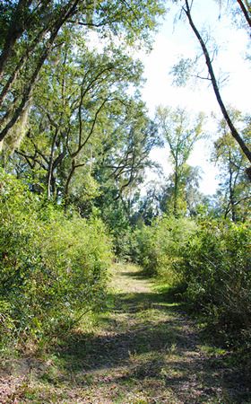
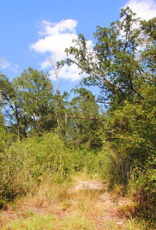
You can park in the parking lot down by the old bridge and take the hiking trail marked with blue blazes, or you can park on the dirt road paralleling the power lines which is much closer to the mansion site, and pick up the trail where it crosses the dirt road alongside the railroad tracks. I did the latter as it was Florida in August and the temperatures were in the upper 90s and I wanted to minimize my time in the heat as best I could. Finding what I was looking for was certainly much easier with GPS coordinates and a blazed trail, but even so, it was not easy. Given the location of the mansion site relative to the road, I had assumed that I would discover it before I found the cemetery. While unnatural topography resembling old roads and the existence of plants such as crepe myrtles at the GPS coordinates I'd brought led me to believe that I was indeed in the right place, I saw none of the ruins I'd come to find

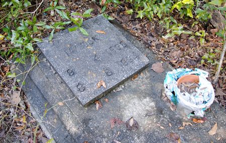
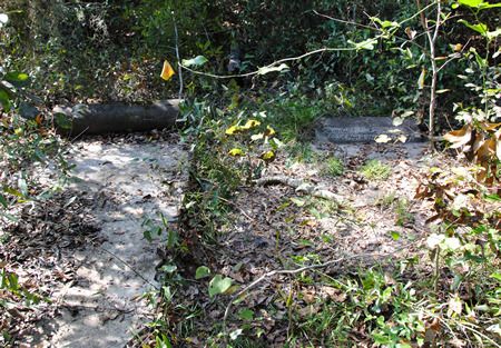
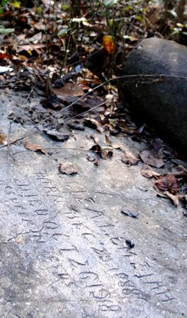
I continued to follow the blue-blazed trail, however, and it did lead me to the cemetery. I wish I knew more about the cemetery; if any of you have information on how many graves are actually there and who is buried in them, I would love to know! Only two graves had readable inscriptions, and most seem to have had their headstones removed from their bases. At some point a survey must have been conducted of the site, as the graves (both the marked and unmarked) had been flagged... but the flags seem to have been out there for a long time.


John Clay Thomas, died 1890, age 42
According to this site, he was a shoemaker.


Side view of John Clay Thomas's grave


Mary Amelia Brush, 1873-187?


Base stone with unreadable remains of headstone


I counted seven other base stones, all missing their headstones.

Leading into the woods from the cemetery in the direction where I knew the ruins of the mansion were said to be was an unmarked footpath. I set off down it, and even though it petered out rather soon, the woods were open enough that walking through them wasn't difficult. I headed back in the direction of the GPS coordinates that I'd brought with me, and eventually I did stumble upon the ruins. They weren't exactly at the coordinates I'd brought, but they were close. So, what was this mansion that I'd come looking for? Well, as I mentioned above, it was built in 1868 and was the home of Florida Governor George F. Drew. However, by the turn of the twentieth century, the community in which the mansion had been built was already in decline, and the mansion was clearly in the early stages of decay by the 1930s. It sat, crumbling in the woods, victim of nature and vandalism, until it succumbed to arson in the 1970s.

Drew Mansion, 1880s (source)


Drew Mansion, 1950s (source)


Drew Mansion, 1960s (source)


Drew Mansion interior, 1960s (source)


Drew Mansion interior, 1960s (source)

Now, before we move on to my photos of the ruins, I want you to take a good look - not only at the photos posted above, but at the following one as well, specifically at its base:


In every image I have seen of the Drew Mansion, it is built on brick pilings up off the ground. It does not have extensive walled foundations. The mansion itself was built almost entirely of wood, with the exception of the aforementioned brick pilings and its chimneys and fireplaces. One would, therefore, expect the mansion's post-arson ruins to consist of brick pilings, brick fireplaces, and brick chimneys. However, the ruins that I (and apparently everyone on the internet who has visited the ruins that are, ostensibly, of Drew Mansion), have found extensive brick foundations which do not match anything I have seen in any of the pictures of the mansion. So what is it that we have found? What is it that everyone who visits this site proclaims to be the ruins of the Drew Mansion? I have no idea. It was big enough, certainly. Here are my pictures; you be the judge:


It was something, alright, but the Drew Mansion? I have my doubts.

For more on the history of Ellaville, including a comprehensive set of links, 
please check out Exploring Ellaville, Part 1.

Sunday, November 1, 2015

Asberry Cemetery

I have to admit that, as Halloween approached, I thought that an easy cheat for this new blog would be to find an old, photogenic cemetery where I could snap some scenic-n-spooky pics to post here. I checked with Google to see if there were any cemeteries near my drive home, and noticed one - located near the end of a dirt road between Traxler and High Springs - that I'd never heard of before: Asberry Cemetery.
The road itself was quite scenic - tree lined, dirt, passing alongside numerous farms raising horses, cows, goats, and donkeys. The road didn't use to be a dead-end, although it was truncated in 1995 by the limerock mining company which purchased the large tracts of land located at its end.... as well as the property upon which the Asberry Cemetery is located. 

I didn't know any of this when I went hunting for it. I was expecting normal cemetery-looking cemetery. Instead, I came to an earthen blockade and a sign saying that the road was closed to through traffic. I was surrounded by trees and overgrowth, and there was no visible sign of anything resembling a cemetery. According to Google Maps, the cemetery was just to my south inside the wooded area. Now I am all for exploring strange and unknown places, but wandering into unknown woods all by myself in search of a cemetery – much less on the Friday before Halloween – gave a me a little bit of the heebeejeebies. I did it anyway.

On the south side of the road, in the general direction where Google claimed there was a cemetery, there was a gate leading to a cleared path into the woods. I followed it.

 photo ac1_zpsdjmyfp55.jpg
An open gate on my right; the road dead-ended behind me.

 photo ac10_zpsyh0vjntq.jpg
The path itself seemed fairly well maintained... except that it, too, dead-ended.

I expected the path to lead, perhaps to a clearing of some sort, where the cemetery would be located. Instead, the path dead ended in a giant block of limestone. There was no sign of a cemetery anywhere, and my sixth sense was definitely screaming heebeejeebies! at me, so I turned to go. Out of the corner of my eye, something glinted and caught my eye. It was a fairly new metal grave marker, but minus any sort of identification.

 photo ac9_zps3jhsdma6.jpg
Clearly a modern grave marker from a funeral home

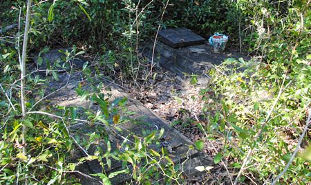
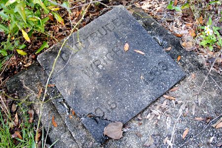
At first I thought that the metal marker was the only grave, but as I turned to go, I spotted two more: Gertrude Wright and Catherine Mazon:

 photo ac8_zpsn1tvicq2.jpg
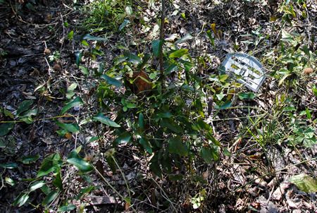
Remains of potted flowers sat atop one of the graves.

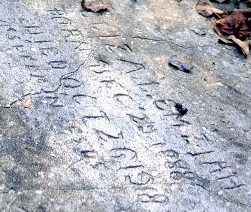
The graves were overgrown and surrounded by brush. At first glance, they looked quite old; however, I was surprised that when I brushed the leaves off of them the dates were actually quite recent. Gertrude died in 1989, and Catherine in 1994.

 photo ac7_zpsvifirz0p.jpg
Getrude Wright: 1915-1989

 photo ac6_zpsfqpqscxm.jpg
Catherine Mazon: 1938-1994

The idea of such recent graves, untended and overgrown and out in the middle of nowhere, was a little unsettling. I snapped some pictures and decided to head out. Halfway back to my car, I stopped to take a picture of the path, and yet again I noticed something out of the corner of my eye. This time it was a little orange survey flag… marking yet another grave.

 photo ac5_zpst6dbsqtz.jpg
Where I stopped to take a shot of the path out of the woods...

 photo ac4_zpstvbjtcqw.jpg
...and the two graves I spotted to my left.

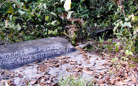
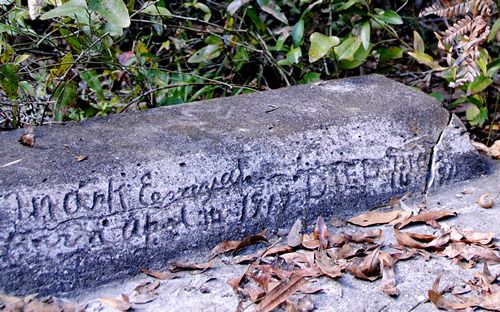
These two graves, marking Eliza and Mark Emziah, respectively, were much older. The engraving was hand-carved. Eliza apparently lived from 1888-1918. Mark was either born in or died in 1917. There was another grave next to Mark’s with no visible writing. I took pictures, and looked around for more graves, but to no avail. Then I skeedaddled because I was feeling just a wee bit creeped out.
 photo ac2_zpsmfccytia.jpg
Eliza Emziah: 1888-1918

 photo ac2b_zps3acsotcu.jpg
Eliza Emziah: closeup
 photo ac3_zpsguhp48s6.jpg
Mark Emziah: 1917...

 photo ac3b_zpsntrlagmf.jpg
Mark Emziah: Closeup

This unmarked, overgrown, untended cemetery has haunted me for the past several days since I found it. How can a cemetery in which people were buried as recently as 20 years ago be abandoned? Who owns the property now? Why is it in the condition that it is in?

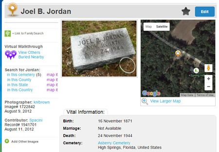
There is very little information on Asberry Cemetery available online. I found one site which labeled several individuals as having been buried in Asberry Cemetery; however, when clicking on the associated map, it turned out that what the website was calling Asberry Cemetery was actually the Spring Hill Cemetery in Traxler.

Here's an example of someone incorrectly labeled as having been buried at Asberry from billiongraves.com:
 photo wrongcemeterty_zpsajhji7i4.jpg
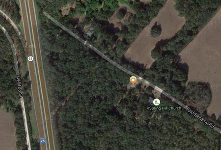
Close-up of the map view:
 photo wrongcemeterty2_zpsemab6z9q.jpg
Note how this is clearly Traxler; Asberry Cemetery is on the western side of I-75.

I did find one website, the Wizard of AR Alachua County Virtual Cemetery Project, which had the most information about Asberry. The goal of the website is to locate, photograph, and identify graves in cemeteries throughout Alachua County, Florida. The Wizard of AR folks visited Asberry Cemetery in 2005… and they located and photographed more than thirty graves. I saw six. There were apparently quite a few more hiding in the underbrush, and pictures of them all can be seen by clicking on the names listed on the Wizard of AR Asberry Cemetery page.

Looking through the photos on the Wizard of AR page, I noticed that several of the grave markers contained not only the names of the interred, but also the names of the funeral homes involved in the burials, specifically Chestnut Funeral Home and Duncan Brothers Funeral Home. A quick Google search revealed that these funeral homes primarily serve the local African American community, which leads me to conclude that this is an African American cemetery. I have tried to determine if there was an Asberry community or an Asberry church, but I have found no information whatsoever.

Regarding the property itself, it is on the eastern edge of a large tract of land owned by a limerock mining company (this information is courtesy of the Alachua County Property Appraiser's website, which has an excellent search function). While the property owners have clearly blocked the cemetery off with large blocks of limerock (thus explaining the large chunk of stone blocking the end of the path that I followed), and they are not conducting any mining on the cemetery grounds, they do not appear to be doing anything to maintain the cemetery itself. Benign neglect? Sigh.
 photo map_zpsayu6qmvm.jpg
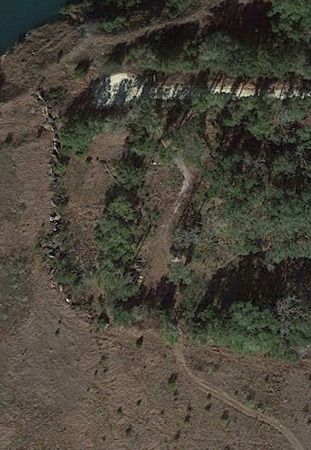
From Google Earth you can see how the dirt road dead-ends in a turn-around. You can also see the limerock "wall" that not only blocks the road, but separates out the cemetery's territory from the rest of the mining territory. The 'path' which I walked looks more like a road from this shot, although it was blocked with a giant limestone rock at the treeline.