Saturday, January 30, 2016

Suwannee Springs

In 2013, I spent my summer in the country of Kyrgyzstan. I spent one month in the tiny village of Bar Bulak, known mainly within Kyrgyzstan for its hot springs. People come to Bar Bulak from around the country to soak in the water and thereby achieve a myriad of health benefits. According to the sign (pictured below), “The Hot Springs is helpful for the following illnesses: arthritis and other afflictions of the joints, stomach acid (heartburn and ulcers), intestinal ailments, liver and gall bladder problems, nervous disorders, and chronic female ailments.”
The hot springs at Bar Bulak, Kyrgyzstan in 2013

While the quaint, old-fashioned notion that soaking in mineral waters helps alleviate various illnesses is still a commonly held belief in Kyrgyzstan, it hasn’t been an accepted therapy in the United States for nearly a century. However, at one point in time the belief in the therapeutic properties of basking in mineral waters was popular in the United States. Tourists flocked to Florida to take the waters of the state’s numerous springs in hopes of enhancing their health. At the time, one of the most popular restorative springs destinations was Suwannee Springs (also known as Suwannee Sulphur Springs, for the sulphur-content of its water).

Beginning in the 1880s development of the springs for tourism purposes began. Over the years, three different hotels, a springhouse, and numerous cabins were erected, as well as a train station located a mile from the springs, connected to the facility by a horse-drawn trolley line. The first hotel, with 125 rooms, was built in 1883, but it burned to the ground the following year. The second hotel was built concurrently with the approximately 15 cabins shortly thereafter, although the second hotel, too, succumbed to fire in the early 1900s. The cabins and the much smaller hotel annex (third hotel) remained open for business for several subsequent decades. Visitors were urged not just to swim in the springs in order cure their ailments, but to drink the restorative waters as well.


Second Hotel from 1885; horse-drawn trolley in front. (Source)


Suwannee Station, about a mile from the springs. Passengers would disembark and travel to the springs and hotels via horse-drawn trolley. (Source)


Suwannee Springs in the 1890s (Source)


Suwannee Springs with adjacent railroad and horse/cart bridge, 1890s (Source)


Cottages, 1885 (Source)


Same cottages, 1974 (Source)

What remains of two cabins, the springhouse, and the third hotel (which was later converted into a store), can still be seen today, in addition to the pilings from the old railroad bridge and former automotive bridge, abandoned in 1971 when highway 129 was routed onto a new bridge a quarter of a mile to the north. The following pictures were taken by me in 2014 and 2015.


Springhouse


Springhouse


Water flowing from the springhouse into the Suwannee River


External wall of the springhouse


View from inside the springhouse, facing upriver.


All that remains of the old railroad bridge.


The old road from the springhouse to the cottages.


One of the two remaining cottages.


The other remaining cottage.


Remains of the third hotel's kitchen annex, which operated as a local store for many years.


The automotive bridge over the Suwannee River, closed to cars since 1971.


Bridge Closed sign north of the bridge is barely legible - and unnecessary as there is no possibility of vehicular access from the north.

The remains of Old 129 dead end at Sugar Creek, a short walk north of the bridge.

More information is available at the following links:

Wednesday, January 20, 2016

Separate but Equally Desolate

During the last century, integration of schools across the country led to the shuttering of many smaller, segregated neighborhood schools, as counties consolidated education into larger, integrated locations. In theory, integration was supposed to begin in the mid-1950s, following the Supreme Court’s Brown v. the Board of Education ruling. However, as the ruling contained the rather oxymoronic instructions that desegregation was to proceed ‘with all deliberate speed’ areas within the deep south continued with racially segregated education for subsequent decades. As such, all-black schools were constructed in Florida, even in the post-Brown environment. It’s hard to find information on which schools existed where in Florida in the mid-twentieth century, especially for an armchair historian operating mainly with Google and word of mouth; however, I have located the desolate and dilapidated remains of two in Columbia County from that era – one for black students, and one for white.

Fort White Bethlehem School

I first learned about the existence of the Fort White Bethlehem School from comments I received on facebook after posting about the Columbia County stretch of the Old Bellamy Road – the modern remnants of which end just to the east of the town of Fort White. Several folks commented to mention that there had once been an all-black school in the area, located at the intersection of Legree and CR18. From what people have told me, the school was in operation as late as the mid-1960s, and was closed only when Columbia County finally desegregated its school system. The building that remains today was built in the 1950s. 


This was as close to the Fort White Bethlehem School as I could get.


Shooting with the zoom lens a bit :-)


There is a second structure located behind the main school structure, which also appears to be part of the school.


A closer look at the rear building, shot through my zoom lens. This construction resembles that of many of the wings at various Columbia County schools, and is clearly a later addition.


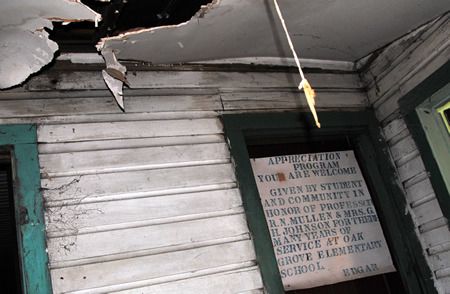
This shot is of the interior of an unidentified all-black school in Columbia County (from here). It may not be of the Fort White Bethlehem School, although it is of that era.

Rosenwald School (schools built for African American students paid for by one of the owners of the Sears-Roebuck Company, Julius Rosenwald) named the Bethlehem School was built in Columbia County in 1927. The remaining structure of the Fort White Bethlehem School is clearly 1950s-era. I do not know whether or not the 1950s school was located in the same location as the Rosenwald Bethlehem School. However, not too far from the remains of the 1950s Fort White Bethlehem School is the modern-day Bethlehem park and community center, and a Bethlehem Church road leading (not surprisingly) to the predominantly African-American Bethlehem United Methodist Church. This leads me to believe that the Rosenwald Bethlehem School would have been in that area, if not in the same location.


Rosenwald Bethlehem School in Columbia County, 1927 [source]

The remains of the 1950s Fort White Bethlehem School are easily seen from CR18 if you know where to look, although they are privately owned and securely fenced off to discourage exploration. 

[A HUGE thank-you goes to Chad Cray for finding out the name of the school for me, and for telling me about Rosenwald schools!]

Murray Hill School

In contrast, Murray Hill School was an all-white school, locate to the north of Lake City along Hw 441. I learned of its existence after posting a picture of the remains of a convenience store and gas station built in the 1930s alongside 441 to a Lake City facebook group. Several people commented that they used to walk to the store after school let out at Murray Hill School. Several comments later, and I knew exactly where the school was located – at the intersection of Murray Hill road and 441 – although I was unable to learn when it was built or its years of operation.


Murray Hill School


Murray Hill School


Convenience store and gas station built in the 1930s by the John Raleigh Hall family. Students from the Murray Hill School used to walk to this store after school.


The remains of the Murray Hill School, too, are easily seen from the road (441), although this building is also privately owned and securely fenced.

Friday, January 15, 2016

Somewhere in Putnam County....

Thus far, all of my posts have been accompanied by stories, whether the stories of how I found the places about which I wrote, the histories of the places, or a combination of the two. Everywhere has a story… but not all stories can be shared – and not all stories should be shared for various reasons, including both security and privacy. In some cases, I simply do not know the history or background of a place. In other cases, I feel that it is in the best interest of the place in question for me to keep what I know about it secret. Sometimes it’s a combination of the two. In any of those scenarios, I will instead allow my photographs to tell the story. This is one such scenario.

 photo jcc1_zpscoatfrl9.jpg

 photo jcc9_zpsmyixa24e.jpg

 photo jcc8_zpsqr4ruqxq.jpg

 photo jcc7_zpskkpbitg4.jpg

 photo jcc6_zpsb1xvb7zp.jpg

 photo jcc5_zpsp9ozady5.jpg

 photo jcc4_zpsj1bmr7qf.jpg

 photo jcc3_zpsejiyttec.jpg

 photo jcc2_zpskvsfbtcw.jpg

Friday, January 8, 2016

The Original High Springs

When I was looking at real estate in and around High Springs (where I did, eventually, purchase a home back in 2014), I remember having a conversation with my mother in which we mused about the reason why High Springs was named High Springs. We thought the name was a bit odd, as it wasn’t as if there were a spring in the center of town or anything. However, we decided that perhaps the name probably came from the high quantity of springs in the near vicinity of the town; Poe, Gilchrist Blue, Ginnie, and Rum Island springs are all short drives from High Springs, and many other springs are accessible via the nearby Santa Fe River. This is apparently the etymology of the town’s name that many people in North Florida believe, although it turns out that it is not, in fact, correct.

While doing research for my various High Springs railroad posts, I learned that there had indeed once been a spring in High Springs proper. According to the Architectural and Historical Survey of High Springs, Florida, published in 1990, “The spring that gives High Springs its name is located a mile northeast of the current center of town, in what is now a pleasant residential suburb. Its steady flow of water attracted settlers in the latter part of the nineteenth century, and the first group of buildings – a school, a few stores, and several homes – was built here. The railroad tapped this spring and diverted its flow, via a long pipe, to the site chosen for the railroad shops.” As I continued to search for more information on the railyard in High Springs, I came across several other mentions of a spring on top of a hill north of town giving rise to the town’s name… but where had the spring been?

I got my answer when JOM and I visited the High Springs Historical Museum to learn more about the railroad back in the fall. We were told where exactly this ‘hill north of town’ was located, that there were remains of the springhouse, and that the spring itself even still flowed. Sort of. In a bit of a trickle. We also learned that there were plans being discussed to clean the area up and turn it into a park – perhaps even to restore the springs – although nothing had been decided.

Due to busy schedules and plans to explore other places, I didn’t get a chance to follow the directions I’d been given in search of the old springs until yesterday. And as JOM is off cycling around Australia, I went hunting for it by myself. The directions I’d been given led me up a hill and to a trail entering a wooded area northeast of downtown High Springs, and while they weren’t too specific for once I reached said wooded area, I vaguely remembered being told that the area was marked off with caution tape. Shortly after entering the woods, I began to come across the remains of structures: foundations, collapsing remains of wooden walls, and concrete structures. Initially I thought I might have found the old springhouse… until I noticed the old tobacco barn behind it. That didn’t seem to fit what I was looking for. Additionally, I couldn’t find anything that resembled a spring – not even a trickle.
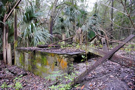
 photo ohs1_zpsh66cxbdv.jpg
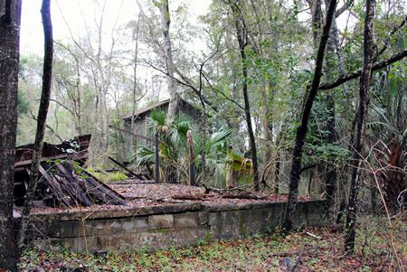
Foundations of something

 photo ohs2_zps20rshbe0.jpg
More foundations; tobacco barn in the distance

 photo ohs3b_zps9vcretqi.jpg

 photo ohs3_zpsnbv4xlzx.jpg
Collapsing wooden structure

 photo ohs4_zps0fiqzutq.jpg
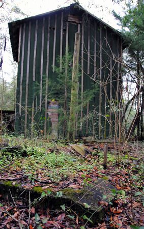
The tobacco drying barn told me I was looking in the wrong place.

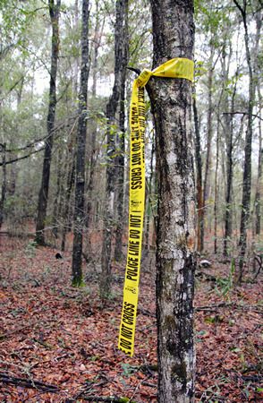
And so I continued on, following the trail until in the distance I saw what looked like yellow caution tape tied around a tree:
 photo ohs5_zpshmhwrz8a.jpg
Er. That’s caution tape, right?

Looking into the woods, I could see another band of yellow tape around another tree, and then farther into the woods, yet another. Following a Hansel and Gretel breadcrumb trail of police-line-do-not-cross tape into the forest all by your lonesome is surely a good idea. I figured either this was the caution tape that I thought I remembered hearing about, or I’d find myself arrested for trampling over a murder scene. As there hadn’t been any recent murders in the area (to my knowledge anyway), I figured I had to be on the right track. Safety first!

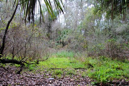
The pieces of yellow tape did indeed lead me to the spring – or what was left of it – and I would never have found it without them. When I finally reached the last piece of yellow tape in the trail, I could see what looked like a round clearing in the woods. It was impossible to get a photograph that showed what I could discern: a near perfect circle of slightly depressed land covered in weeds and small trees, surrounded by much older trees. Venturing into the depressed circle, I could tell that this had indeed once been the spring head pool. Around the edges older oaks leaned over what would have once been water. The ‘pool’ itself was nothing but mud – wet enough to show that water was still seeping to the surface, but dry(ish) enough to walk across, although my shoes definitely sunk into the mud in spots.

 photo ohs6_zpsnkpwqrii.jpg
What remains of what would have been the spring's pool

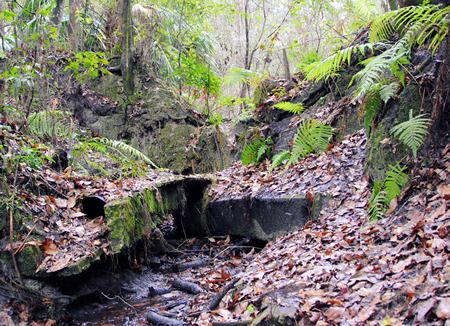
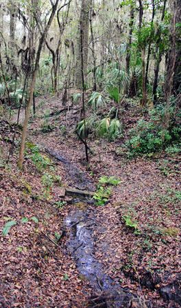
On one end of the former ‘pool’ the remains of a dam and pipe could be seen… and flowing through it and down an old creek bed was the trickle of water I had been told to expect.

 photo ohs10_zpsfcekmiuz.jpg
Remains of the dam. The round object in the lower left quadrant is a pipe.

 photo ohs7_zpsupnlmxgv.jpg
The stream, trickling east from the dam/pool

 photo ohs9_zpspntb6tre.jpg
Looking back towards the spring from downstream; the dam is at the top of the hill.

On the opposite side of the ‘pool’ I found three large metal bolts extending inward from the ‘pool’ wall. I've no idea what their purpose would have been.

 photo ohs13_zps8snqnrqr.jpg

 photo ohs14_zpsmo0nitjt.jpg

 photo ohs11_zpsc5pzr2e0.jpg

The complete set of photos taken on my explorations in search of the original High Springs Spring can be seen HERE.

According to the Alachua County Property Appraiser’s website, the piece of land upon which what remains of the spring sits belongs to the City of High Springs, which would certainly simplify the process of turning it into a city park. Of course, whether or not this actually comes to fruition definitely remains to be seen. And restoration of the spring itself? I do not know if such a thing would be possible, although if it were, that would indeed be lovely.

Saturday, January 2, 2016

Hotel Blanche

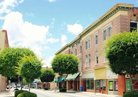
I’ve mentioned before that I grew up in Columbia City, a tiny crossroads in south-central Columbia County. I was actually born in the town of Lake City (the county seat of Columbia County) and had a Lake City mailing address for the first eighteen years of my life. Columbia City was (and still is) just a crossroads with a flashing light and a convenience store or two. If my family wanted to buy pretty much anything, that involved driving twenty or so minutes into Lake City. I’m now in my late thirties (shhhh!) and I’ve lived away from Columbia County longer than I lived in it. Still, I’m old enough – and I lived there long enough – to (vaguely) remember downtown Lake City as the center of commerce for the community. I remember being a little kid, going downtown with my parents to shop at McCrory’s, Rowands, and JC Penney. I’m also old enough to remember one of old buildings burning down, JC Penney relocating out to the brand new mall in what would later become ‘the strip’ several miles from downtown, and the final death knell for commerce in downtown: the opening of the Lake City Walmart (also on the strip). Downtown wasn’t really a place one went anymore after that. A few businesses hung on through the years, gradually closing their doors as owners retired, moved locations, or simply couldn’t make a profit. While a handful of the old businesses do remain to this day, downtown Lake City is nothing like it was when I was a small child.

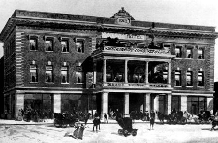
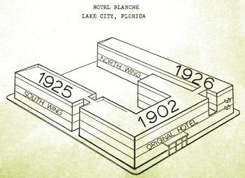
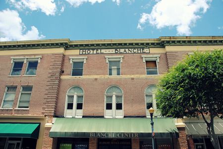
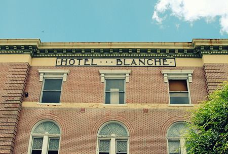
However, while I am old enough to remember, however vaguely, an active commercial district in downtown Lake City, what I am not old enough to remember is an open Hotel Blanche, as it ceased operation in 1967, quite a few years before I was born. The original part of the Blanche was built in 1902 by architect Frank Milburn and builder Henry Otis. It was expanded to include a north and a south wing in the mid-1920s, in order to accommodate demand. Located at the northern end of the state, and centered along both railroad lines and the burgeoning highway 441 – one of the major north-south highways prior to the construction of the Interstates – Lake City earned its nickname ‘the gateway to Florida,’ and the Blanche was where the wealthy stayed when they arrived in the state, hosting notable visitors from Al Capone to Johnny Cash over the years.

 photo blanche12_zps2kb9oqux.jpg
Hotel Blanche, 1902

 photo blanche_1906sanborn_zpsgqnq4wod.jpg
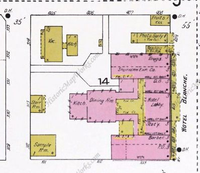
Layout of the hotel according to the 1906 Sanborn Map

 photo blanche14_zpsxv0ttwx4.jpg
Source: Columbia County Historical Museum

 photo blanche13_zpsu0evkumn.jpg
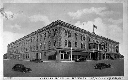
The hotel in 1943

With train travel replaced by private cars and the construction of I-75 (which bypassed the Blanche by several miles), demand for rooms at the Blanche declined; it ceased operating as a hotel by 1967. My memories of the Blanche are of it being an increasingly dilapidated structure at the heart of downtown, often home to various businesses on the ground floor, but never anything particularly permanent. There was a thrift store we used to go to on the ground floor for a while – I always liked trying to imagine it as part of the old hotel – but other than that, I don’t think I’ve ever been inside any of the hotel. Despite this fact, the slowly disintegrating Hotel Blanche has always been the centerpiece of downtown Lake City in my mind.

 photo blanche3_zpsqg2or3ig.jpg
The colorful posters in the shop windows have been placed in all the empty storefronts to mitigate the feelings of emptiness and desolation.

 photo blanche1_zpsqydgypis.jpg
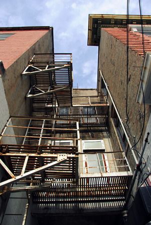
The center of the original hotel structure, external balconies long since removed.

 photo blanche2_zpsn5z9rqwp.jpg

 photo blanche11_zpsyzhemgnd.jpg
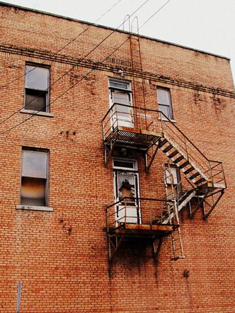
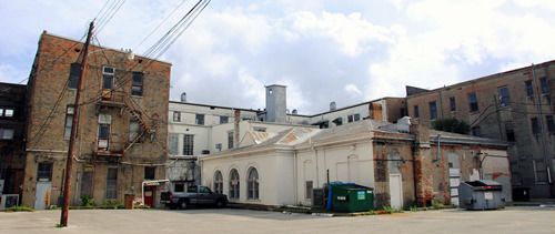
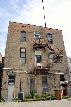
The rear of the north wing

 photo blanche10_zpsvg7a9pco.jpg
Center rear. The central structure comprised the dining room (front) and the kitchen (rear).

 photo blanche8_zpsnyur1lln.jpg
Rear of the northern part of the original 1902 structure.

 photo blanche7_zpszteceg2n.jpg
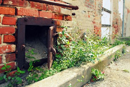
The base of the kitchen's chimney.

 photo blanche5_zpsjtgsnmve.jpg
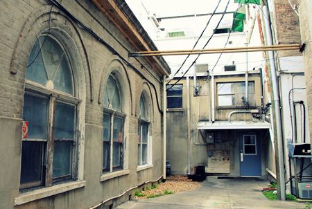
To the left, windows into the old dining room

 photo blanche4_zpsht6jjprl.jpg
The connection between the original south side and the south wing

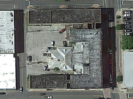
 photo blanche_google_zpsaggyyuqr.jpg
Aerial view from Google

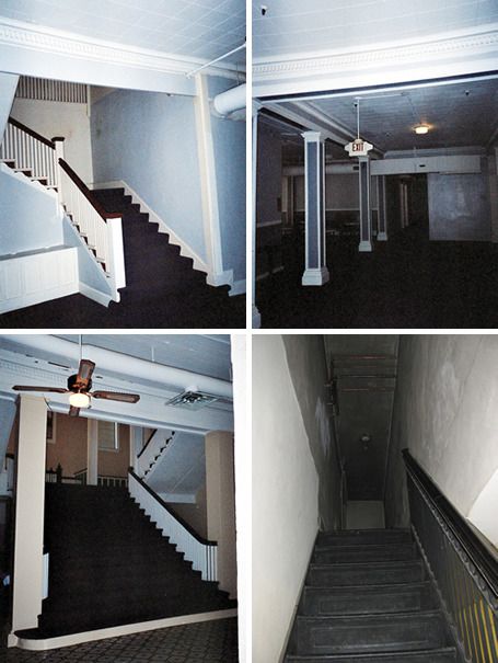
Despite growing up in Columbia County, I never heard any rumors of the Blanche being haunted. I’m not one who believes in ghost stories, but I’ve always loved hearing them. I’d like to think that if there were rumors of the Blanche being a haunted structure, I’d at least have heard them. Perhaps I was too young, or perhaps I was too disconnected from the folks who continued to work in and around the building. Or perhaps the alleged haunting of the Blanche is merely a construct of the internet age. I say this because despite never having heard ghost stories pertaining to the hotel, there are mentions of it here and there across the web on various paranormal investigatory sites. One paranormal investigator apparently gave a presentation at the Blanche back in 2006, sponsored by the Columbia County Public Library – and later that evening explored the interior of the hotel seeking ghosts and other phenomena. He claimed the building is inhabited by quite a few restless spirits, and may or may not be the location of some sort of, um, portal. You can read the account here. It’s quite interesting to say the least. The paranormal investigator also took the following photos during the evening exploration:

 photo blanche15_zpsuopkyomv.jpg
Photos from PSIResearcher

It turns out that there’s a chance the old Hotel Blanche might not remain a Desolation Florida landmark. Now, numerous plans for revitalizing downtown Lake City have been proposed, debated, and even approved over the years – although many such plans never amounted to more than just talk. While many of the old storefronts in historic downtown Lake City are now home to local businesses, just as many (maybe more) currently sit empty. Downtown has not been revitalized. However, this past fall, plans to spend $14 million to refurbish the Hotel Blanche were approved by local government. You can read about this here and here. As you might imagine, the idea of spending $14 million of taxpayer’s dollars is rather controversial. Allegedly, construction will begin this coming March, although to be honest, I’ll believe it when I see it. 

Links about the Blanche: