I am drawn to desolation because I find beauty in the
desolate and the decaying, but I am also drawn to the mysteries surrounding
things which have been abandoned. Something inside me wants not only to explore
and to photograph, but to find out what various abandoned places once were and how
they arrived at their current state. Often, despite the numerous sources that
are available, one can only find out so much, and the remaining mystery
continues to tantalize and draw one in. My previous post about Asberry Cemetery
was one such tantalizing mystery. This post is another.
I spent the other day exploring various dirt roads of north
Florida, which is one of my favorite hobbies. I drove far down a narrow dirt
road in an incredibly rural county, and had actually worried that the road
might be blocked by a gate at some point. While I had been hoping to find
something to photograph, I had expected something along the lines of an old
farmhouse, however what I found was quite different. I was driving along,
enjoying the view of woodland on my right and vast fields dotted with hay bales
on my left, when out of the corner of my eye I thought I spotted something. I
hit the brakes and threw my car into reverse, and there it was. It was an
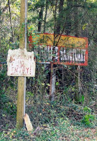
overgrown road or driveway leading into the woods, and there were faded signs –
including a large, faded billboard. This had clearly once been something.
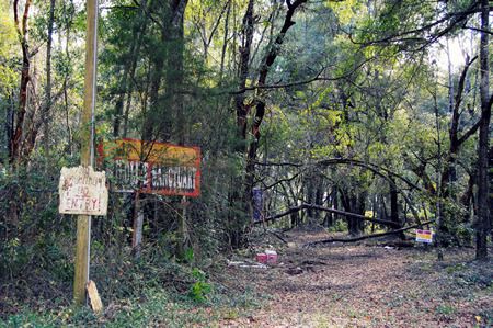
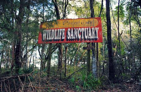
We parked the car and got out. The faded billboard read All
Creatures Wildlife Sanctuary. Another, even more faded and barely readable sign
read No Hunting! No Entry! We didn’t
wish to trespass, but as it was clear that as neither the signs nor the
facility itself had had any recent use, we ventured a short way down the
overgrown drive.
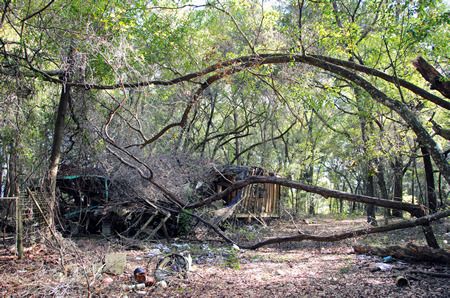
There wasn’t much to see, really, and it wasn’t exactly what
you’d call picturesque. It was, however, both desolate and sad. All that
remained of the All Creatures Animal Rescue, aside from the faded and broken
signage, were some bent and mangled remains of fences, and the collapsed and
stripped remains of a building of some kind.
As an animal lover, and as someone who has done a lot of
animal rescue work in her life (albeit with domestic animals, not wildlife),
this place really got to me. If it had indeed been a fully functioning wildlife
sanctuary, providing homes to ‘all creatures’ as it were, the fact that it was now
little more than a few broken signs and a collapsing pile of rubble was
incredibly depressing. What had happened here? Had it really been a wildlife
sanctuary? Why had it closed? Where had all the animals gone?
I thought for sure that the internet would have all the
answers to my questions; however, as with Asberry Cemetery, there was only so
much that I could discover.
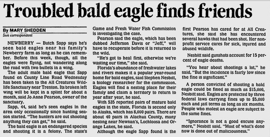
All Creatures Wildlife Sanctuary was active as a registered non-profit from 1987 to 2004. This was the most comprehensive article I was able to on the facility. According to the article, the facility was home to a wide variety of wild animals, including wolves, cougars, bobcats, owls, hawks, deer, tortoises, and more. They were federally licensed to take care for wild animals: those that had been injured and needed rehabilitation (see the article on the rescued bald eagle below), those with permanent injuries or disabilities which would have prevented them from surviving on their own in the wild, and those confiscated from unlicensed owners which had become too 'domesticated' to be released into the wild. Wild animals with shrinking populations were bred at the facility, and zoos from across the country liaised with All Creatures Wildlife Sanctuary to arrange breeding of rare animals. The facility itself ran on volunteer labor and donations. Tours of the facility were by appointment only, and cost $5 per person. Additionally, people seeking to earn their license to work with exotic wildlife, could put in their required 1000 hours of training at the facility.
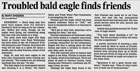
See full sized image HERE
From: Gainesville Sun, January 5, 1991
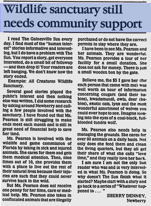
However, life at the All Creatures Wildlife Sanctuary was not smooth sailing. According to this article from 1989 (which cites another that I could not locate), the sanctuary was in desperate need of donations:
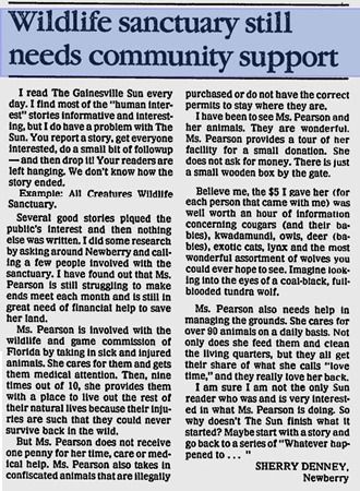 See full-sized image HERE
From: Gainesville Sun, August 20, 1989
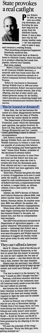
According to these articles, the sanctuary lent its male bobcat (which they used for breeding purposes) to Homosassa Springs Wildlife Park in 1990. The Homosassa Springs Wildlife Park then had him neutered, in what seems to have been some sort of misunderstanding about whether the bobcat was a loan or a gift, which you can read about HERE.
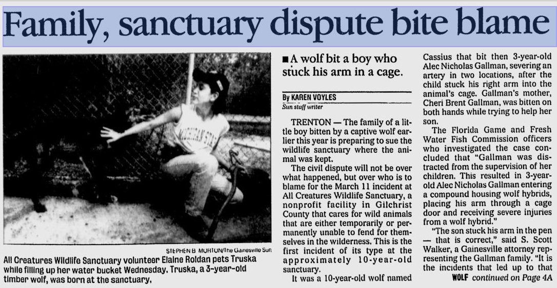
However, what I am assuming (and this is just an assumption) was the death knell for the organization occurred in March 1998. A volunteer brought her children with her when she came to the facility. She left her children unsupervised, and one of them - a three year old boy - stuck his arm into a cage with a wolf, which then proceeded to maul the boy's arm. This incident led to fines levied against the facility for negligence, a federal investigation into safety at the facility, and threats of a lawsuit by the boy's family.
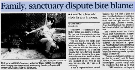 See full-sized image HERE
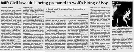
See full-sized image HERE
From: Gainesville Sun, October 12, 1998
And that's it. That's where the story runs cold, at least so far as I could find. The last recorded date of activity at least in the organization's name was 2004. The property itself was sold in 2005 and again in 2006, and it has sat vacant ever since. What happened to force the sanctuary to close? Where did the animals go? I still do not know.


